
Butte or Mesa ?
I knew that this day was looming. The day of La Bajada.
The RT66 forums and blogs warn of its condition and warn against pressing your luck. But, they estimate that in 1928, a thousand cars per day drove this road. So it wouldn’t hurt to go take a look, right?
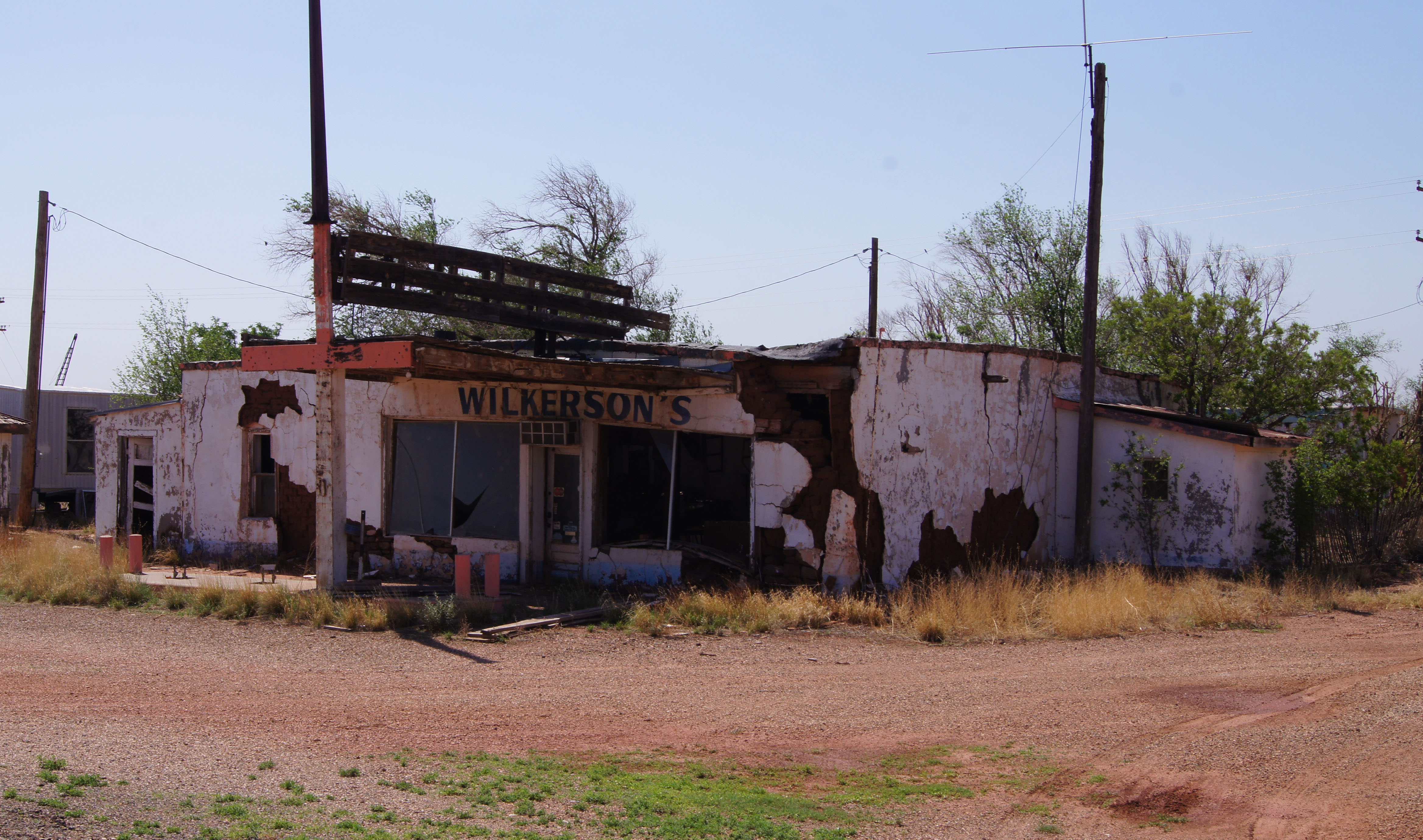
I left Tucumcari early, knowing that it would only take about 244 miles to run today’s alignments and end up in Santa Fe. My bike is ready for its 12K service and in Santa Fe lays the nearest dealer. Passing through Newkirk NM I found some low-low octane fuel, a can of Pepsi that was 13 months past its expiration and some dilapidated buildings. I headed off on an early alignment of RT66 connecting Cuervo and Santa Rosa NM, all on a 2 track road. Being well into mesa country, the scenery was spectacular. A pre-1937 asphalt alignment came next, heading me toward Santa Fe. This alignment went through Pecos and its National Park following the Santa Fe Trail, which has connected Missouri with Santa Fe NM since 1821.
My arrival in Santa Fe was one of my earliest, so during a 2:30 lunch I thought that maybe I should take a run at La Bajada, today. That way any injuries sustained to my bike could then be addressed during tomorrow’s scheduled service. Likewise, any injuries sustained by its rider would then have an extra 2 days to heal. You know… never put off until tomorrow that which you can break today, right?
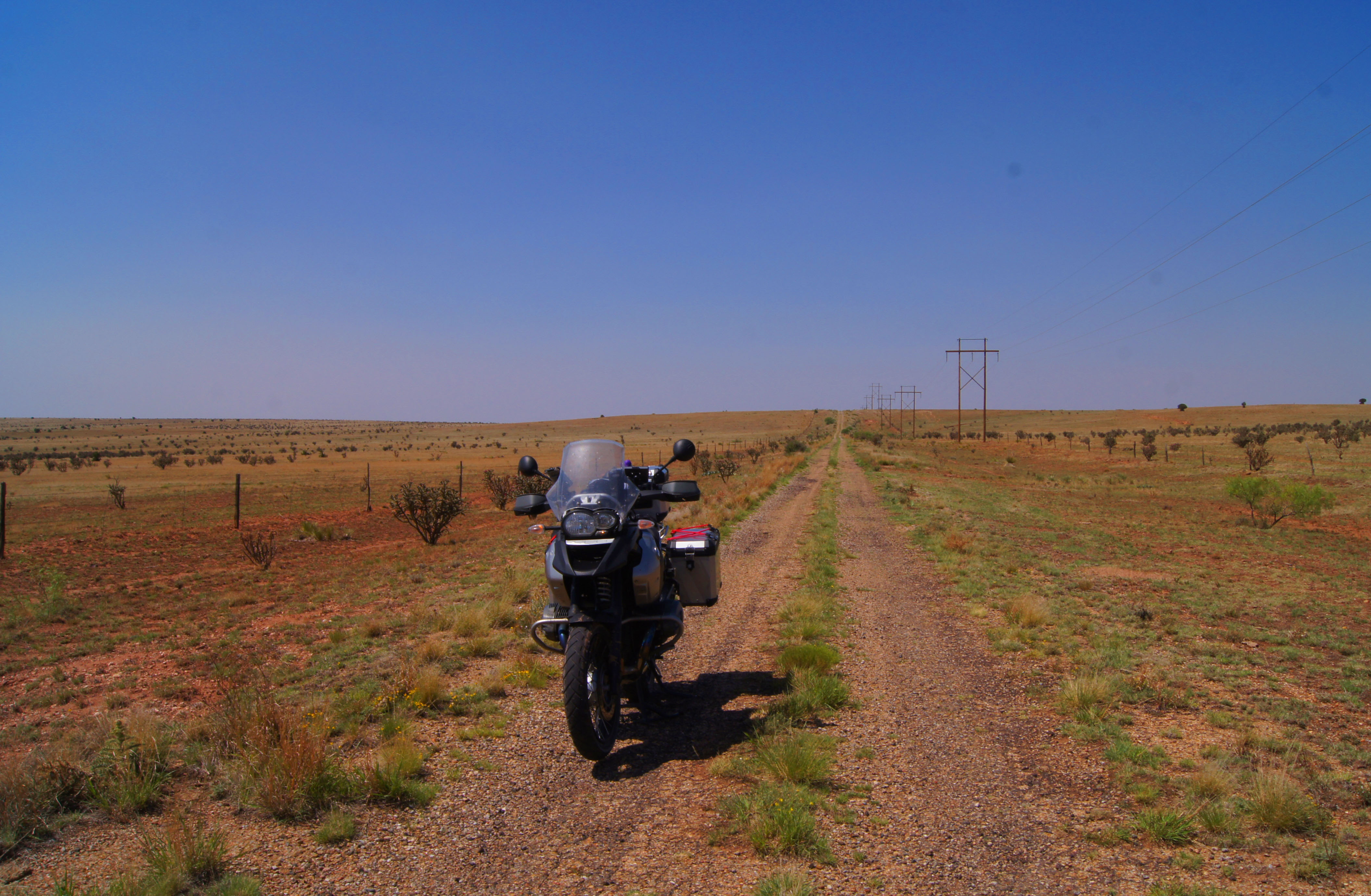
So, with stomach and gas tank now full, I rode out of town to the fork where the “Santa Fe-La Bajada-Domingo-Algodones 1926 to 1932 alignment” begins its 36.2 mile run. The first 5 miles or so were asphalt. Whaaat? So I double checked my GPS to verify that I was on track, and I was. The next 6 miles or so ranged from graded dirt road to a no-one-has-been-here-since-1932 two-tracker. Still passable (if you like slalom skiing), still on track and now joined by a dust devil that just seemed to linger forever. In the near distance things changed to a high volcanic rock (talus) mix with loose sand. Now headed uphill, to what I assumed would be more of the same, things got quite different at the crest. The view of the valley miles below, was spectacular. The “road”…uh, not so much. Suddenly I was longing for my featherweight Honda CRF450x instead of the 630 pound BMW that currently sat between my legs, shod with street tires and laden with panniers, nonetheless. However, slow and steady won the day and I was able to lope and pray my way down the remaining miles. I managed to not disappear into the knee-deep ruts, bounce over the rocks that I couldn’t avoid and counterweight-turn my way around each of the zillions of switchback turns to the bottom, miles below. First and second gears were my only companions and between the 3 of us, we didn’t drop, crash or stall the bike once. The skid plate did become shinier and the center-stand lost some paint, surely.
Thus ended the 2.5 month anticipation of riding the Bajada mesa. Yes, it descends a “mesa” because the landmass is wider than it is tall. Otherwise, if it was taller than it was wide, it would be a butte. But, a beaut, it definitely is!


Categories


Now that sounds like my kind of day riding, beautiful scenery too.
LikeLike
Wow! your bike was suited not many HD’s would have made that section! Well done!
LikeLike
A great ride to be sure. Do you think going uphill would have been easier?
At least you did not have to worry about traffic!
LikeLike
Great pictures Rich. You must feel like Christopher Columbus.
LikeLike
Rt66? Looks like alot of fun. I thought I heard you say one time “I’ll never take this bike in the dirt”? I have enjoyed your photos and blog. Thanks
LikeLike
Well planned trip. Enjoying your writing and pictures daily. You will have a lot great memories of your trip. Thanks for sharing them with us. Be safe on your trip home.
LikeLike
Well a chance to soak up local color and take a deep breath . B
Poor bike really has been thru the ropes, glad you’re ok .I enjoy everyday of pics and your comical wit . Take care
LikeLike